Stolberg (Germany) – the most detailed description with photos, the main attractions and places of interest of the city, location on map.
Contents
City Stolberg (Stolberg)
Stolberg is a small town in western Germany in North Rhine-Westphalia. It’s cute a town near Aachen with a wonderful historical center and medieval castle on the hill. Stolberg lies in the valley of the river Fichtbach on the edge of the Rhine shale mountains and is one of the oldest centers of metalworking.
- Geography and climate
- Practical information
- Story
- How to get there
- sights
- Video
- Maps and guides
- Comments and reviews
Geography and climate
Stolberg is located in West Germany on the outskirts of low shale mountains. The climate is temperate, with mild winters and cool summers. The average annual temperature is 8-10 degrees. Precipitation is distributed evenly throughout the year. Winds prevail east directions.
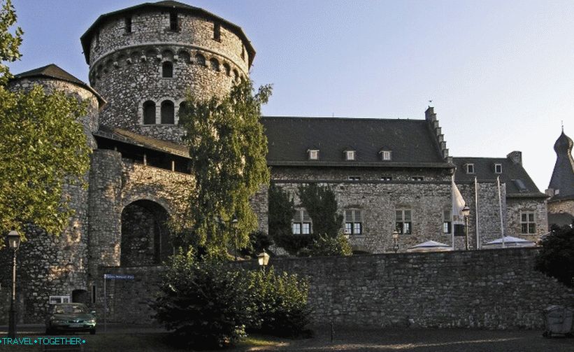 Stolberg Castle
Practical information
- The population of the city is 56,000 people.
- The highest point of the city is 260 meters.
- The area is almost 100 square meters. km
- The official language is German.
- Currency – Euro.
- Visa – Schengen.
Story
Stolberg was first mentioned in 1118. In the 12th century dynasty Stalburg castle was laid on the hill. In the 13-14 century, the castle became their main residence. At the beginning of the 14th century around it was formed small settlement. At the end of the 14th century, the castle was besieged and a little later became part of the estates of the Dukes of Juel. In the 15-16 centuries, the fortress was significantly rebuilt and expanded.
A large community formed around the castle in the middle of the 15th century. artisans. They were mainly involved in the smelting of copper, lead, iron, silver and gold. In 1600 masters joined them Protestants from Aachen who escaped religious unrest. They brought with them knowledge about the production of brass.
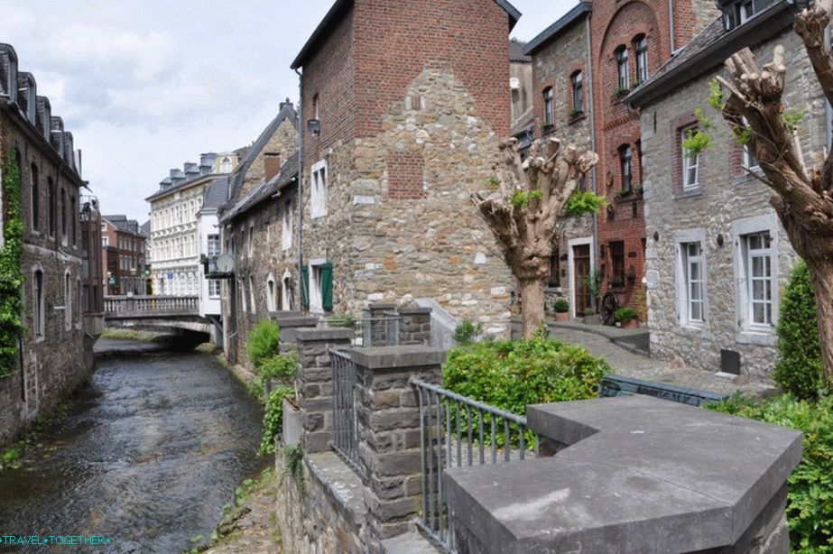
 Historical Stolberg Center
In the 17th century, Stolberg becomes one of the few centers production of brass. This circumstance largely determined economic growth. Often Stolberg is called the oldest brass city in the world.
During the Napoleonic Wars, Stolberg briefly became part of France. But already in 1815 he returned to Prussia. In 1856 year Stolberg received city law. In the late 19th century, a major industrialist bought the castle and rebuilt it in its present form.
 Stolberg
During World War II, weapons were produced here for German army. In 1944, Stolberg was significantly damaged. by bombing.
How to get there
Stolberg is located 15 km from Aachen – a major transport center of westphalia. Aachen has its own small by the airport. The nearest major international airports are located in Cologne and Dusseldorf. From these cities to Aachen can be reached by train or bus, then to Stolberg – by bus.
sights
Altstadt Stolberg retained the layout of the 16th century. It is located with western and southern part of the castle cliff. Main attraction, of course, is the same name medieval a castle that towers on a hill above a maze of old streets.
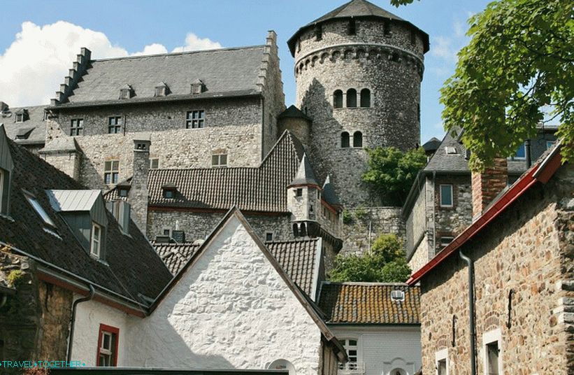 Stolberg Castle
The castle was founded in the 12th century by the Stalburg dynasty. In the 15-16 century after the change of ownership was substantially rebuilt and expanded. It got its modern look in the 19th century, when it was acquired by a major German industrialist. Castle Stolberg is open from 12.00 to 18.00 with April 1 to September 30, from 15.00 to 18.00 from October 1 to 30 Martha.
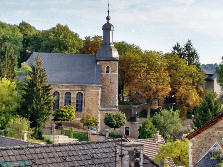
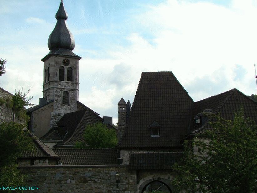 Church of sv. Lucia
Church of sv. Lucia – an old catholic church of the middle 15 century. In the first half of the 18th century, the Order of Capuchins was built. new bell tower.
 Church Finkerberg
Finkerberg Church – a small church of the 17th century, towering over the old town.
 Copper Cemetery masters
The cemetery of the copper masters – an ancient cemetery with a small a chapel where artisans have buried their own from the end of the 17th century the dead.
Video
Maps and guides
Stolberg Map