Saarbrucken (Germany) – detailed information about the city from a photo. The main attractions of Saarbrucken with a description, guides and maps.
Contents
City Saarbrucken (Germany)
Saarbrucken is a city in the very west of Germany, located on border with France, the capital of the Saarland. It is large industrial and university center. Interesting what’s the name the city of “Saarbrucken” is in no way connected to the bridge over the Saar river. When the city arose no bridge, there was no trace. The name is literally, you can translate “rock by the river.” It is on the cliff above the river An ancient castle was built.
Saarbrücken is located in the valley of the Saar river among the picturesque wooded hills almost in the center of the coal basin. Climate moderate with some sea influence. Average annual temperature makes 8-10 degrees. For the year falls more than 700 mm of rain. most of which occur in the warm season. Winters are mild with small frosts, summer is warm. During the year prevail westerly winds.
 Saarbrucken, night
- Practical information
- Story
- How to get there
- sights
- Video
- Maps and guides
- Comments and reviews
Practical information
- Population – 179.7 thousand people.
- Area – 167 square meters. km
- The official language is German.
- Currency – Euro.
- Visa – Schengen.
- Time – Central European UTC +1.
- Among the dishes of regional cuisine stands Schwenker – steak, cooked on a special grill.
- Many bars and restaurants are located in the area of St. Ploschad Square. Johanner Market and the Nauwieser quarter.
Story
In the pre-Roman era in the vicinity of the city was the Celtic settlement. In Antiquity, a Roman settlement was founded here, destroyed during the Alemanni raid.
After the collapse of the Roman Empire in the 6th century in the vicinity Saarbrücken was founded by the settlement of the Franks. The first mention of The city dates back to the 12th century, when the eponymous castle was founded. In the second half of the 12th century the castle was destroyed by order of Frederick Barbarossa. Interestingly, the city of Saarbrücken was the result unification of three villages.
 Night Saarbrucken
In 1353, Saarbrücken became possession of the Nassau clan. In 14 century settlement receives urban rights.
Late Middle Ages and the Reformation period was issued for Saarbrücken sad. The city was almost completely destroyed in during the Thirty Years War, and later burned by the French during their war with the Dutch. In the 18th century, an economic and industrial boom: coal was nationalized and built mines, there were plants for smelting iron. During the Napoleonic Wars Saarbrücken was occupied by French troops. In the second world war the city was heavily bombed by virtually destroyed the old town.
How to get there
Saarbrucken has its own international airport, which located 15 km from the city. R10 bus route every hour leaves from the airport to the main train station. Ticket price is 2.3 euros. Just get to Saarbrucken by car, as the motorway passes nearby A6.
Saarbrucken is a major railway junction. Regular flights connect the city with Frankfurt, Paris and other cities.
sights
The most interesting sights of Saarbrucken
 Castle Saarbrucken
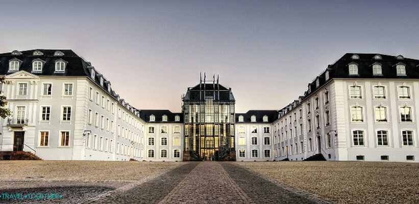
The castle of the same name is the oldest part of the modern city. AT Middle Ages, a former fortress over the Saar River, in the 17th century It was rebuilt into a baroque palace. The first mention of the castle this place dates back to the year 999. After the destruction of the palace during wars of the 17th century, a century later, prince wilhelm heinrich built a new baroque residence. Castle and adjacent palace The square is one of the main cultural centers of the city.
 Church of sv. Ludwig
Church of sv. Ludwig is one of Saarbrücken’s business cards. work Stengel. Considered one of the most beautiful sacral Germany’s Baroque Protestant buildings comparable to masterpieces of baroque Dresden. Was built in the second half of 18 century. Together with the adjacent houses it forms a unique baroque ensemble, almost completely destroyed in World War II war and later carefully restored.
 Market of sv. Yohana
Market of sv. Johan is the heart of the old city. Main square Saarbrücken is a pedestrian zone. Great place for walking along the old streets or get-togethers in cozy restaurants. Also Be sure to check out Fröschengasse, where the old ones are located craft quarters.
 Old bridge
The Old Bridge is one of the oldest buildings in Saarbrücken, built more than 5 centuries ago by Charles V. Old Bridge over the river Saar connects the districts of the old city and the quarter of St. Johan. Now is pedestrian.
 Basilica of sv. John’s
Basilica of sv. Joanna is the baroque masterpiece of Stengel. Was built in 18th century. In addition to the rich interior decoration should be noted bronze portal and organ.
 Town Hall of sv. John’s
Town Hall of sv. St. John is a beautiful neo-gothic building of the late 19th century. In the center is a 54-meter high tower, and the facade is decorated sandstone figures.
 Castle church
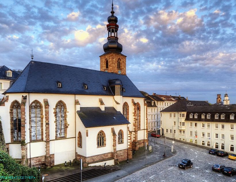
The castle church is a 15th century gothic church to which Stengel in the 18th century added a baroque tower. After destruction World War II was rebuilt. Here are the tombs the last princes of the land of Saar.

Church of sv. St. John is a neo-gothic church built in Saarbrücken at the end of the 19th century.
 Saar crane
Saar crane – port crane, built in the 18th century. Certificate Saarbrucken’s trading past.
 Church of sv. Arnuala
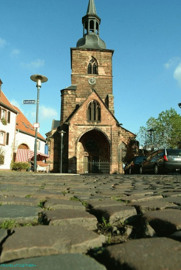
Church of sv. Arnuala – 13th century gothic church is one of the most important architectural monuments of southwestern Germany. Located in one of the oldest districts of Saarbrücken. it a kind of “village inside the city” has kept the charming historical atmosphere and houses of the late Middle Ages.
Schwarzenberg Tower – 46-meter tower with a viewing platform, located on the highest point of the Saarbrücken Forest. To enjoy the fantastic view you need to overcome 241 step.
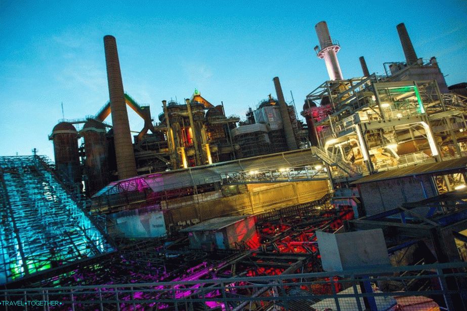 Metallurgical plant in Völklingen
The plant in Voelklingen is an object UNESCO World Heritage Site. This is a huge industrial facility. decommissioned in 1986. Is the only one in the world’s iron and steel plant, which preserved in pristine condition and impressive evidence of the engineering and industrial heritage of the 20th century.
Video
Maps and guides
City Map with Landmarks


